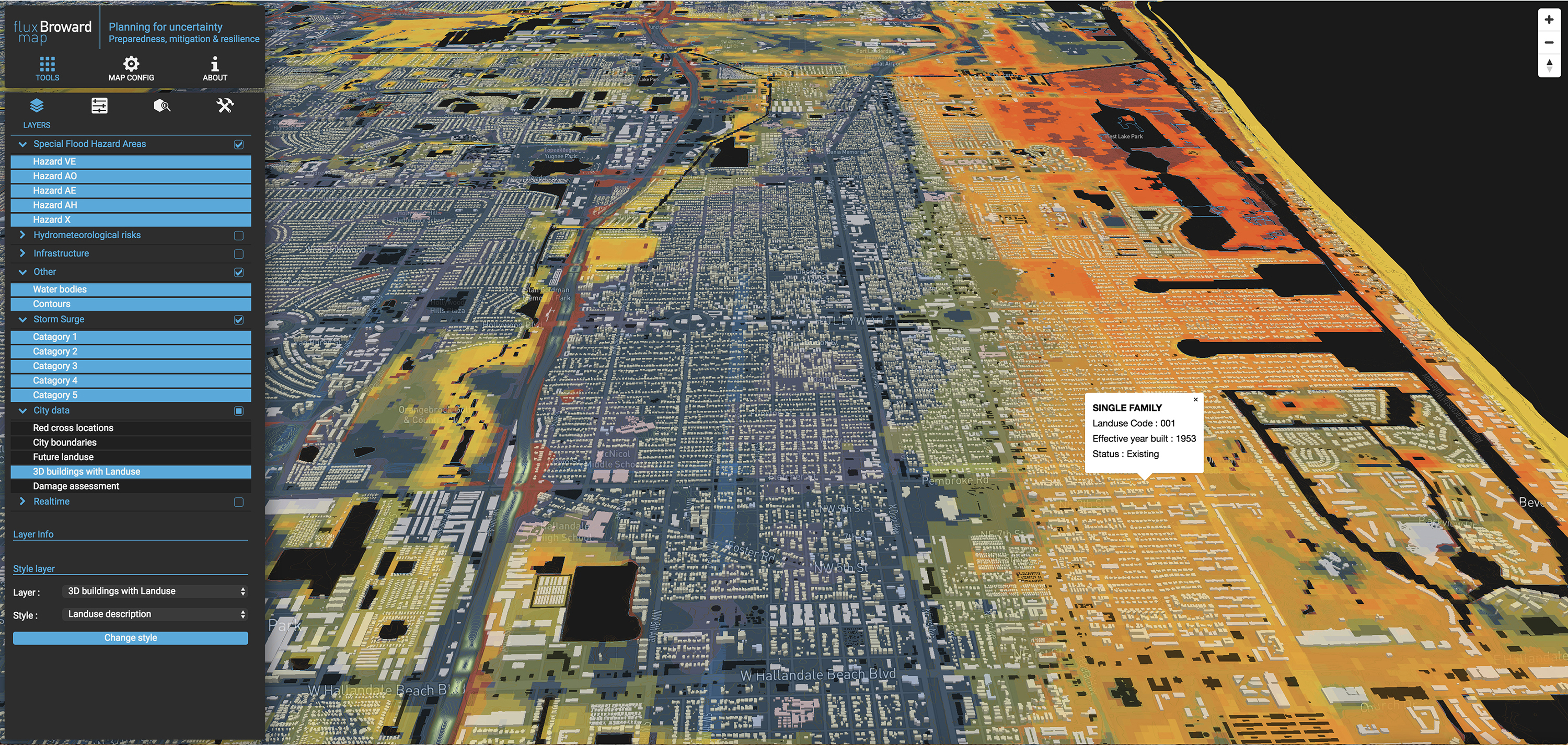
Reductive land use policies, such as the universally adopted Land-based Classification Standards (LBCS), have formed the basis of our cities' land use zoning laws for almost a century. LBCS describe land parcels' permitted uses (residential, commercial, industrial, etc.) absent a robust and nuanced description of the land itself. LBCS also jettison the scenario-driven models needed for climate-based adaptive, resilient design, as they are static and negligent to factor in the dynamic conditions of changing landscapes. In many places, these normative zoning codes have rendered themselves extraneous in genuinely dealing with climate change impacts. For example, some regions continue to be zoned for typical future residential land use, knowing they are under severe future flooding risk. We simply ask land-uses land use zoning to remain static when we know that landscapes are truly dynamic?
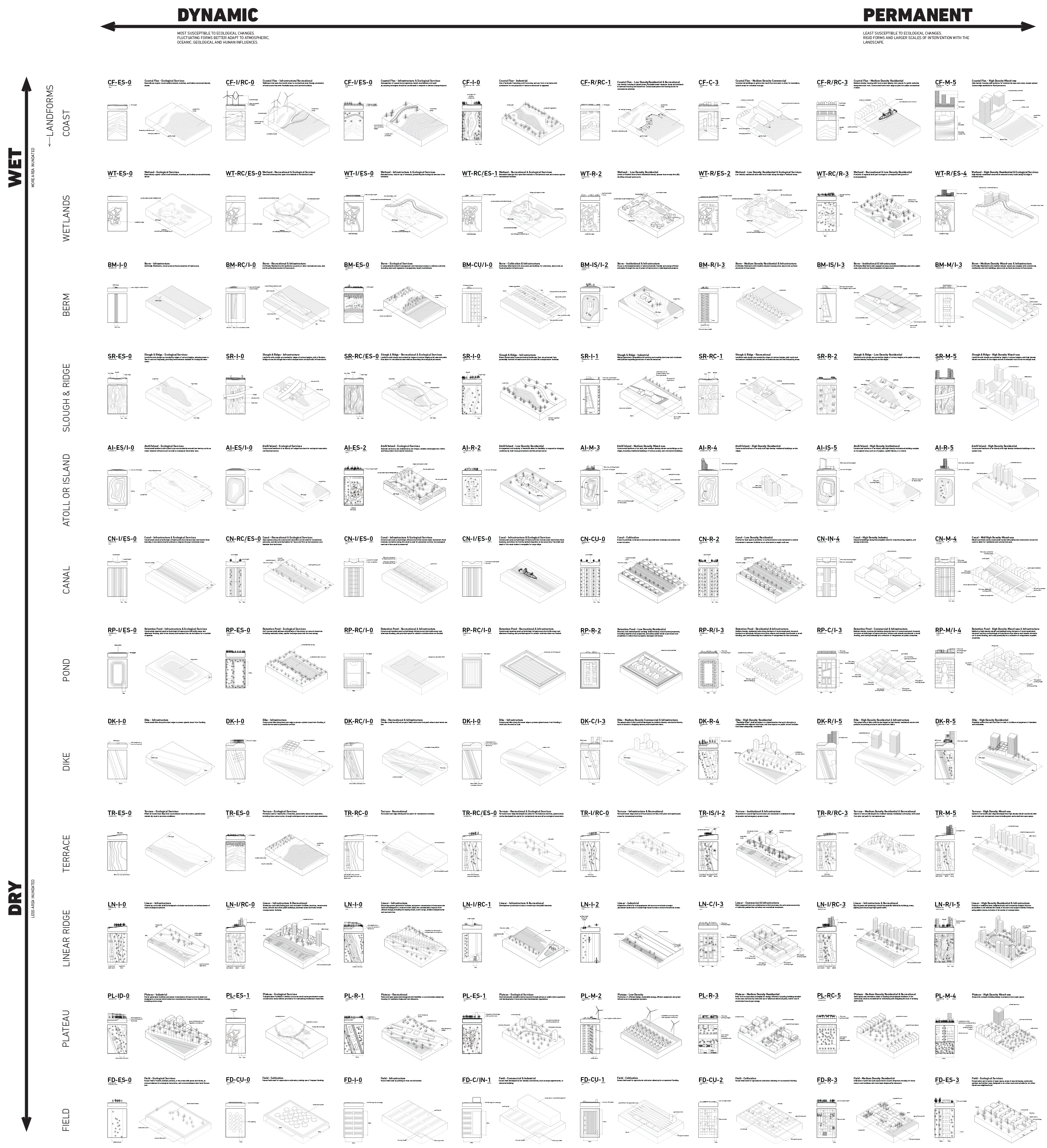
Normative (or traditional) zoning has historically relied on two conditions: the regulation of land and the regulation of use. However, the interrelationship between land and use — the temporal conditions and processes that govern their fluctuations — is poorly suited to land use planning's predictive economic model. Flux Codes propose an instrumental layer of the zoning envelope that introduces ecological processes and scenario-driven flexibility into land use regulation. Under the "flux code", the reductive nature of conventional land use would transition into a series of overlapping gradients of uses and conditions - eliciting a multifunctional and dynamic understanding of land use absent from current regulation.
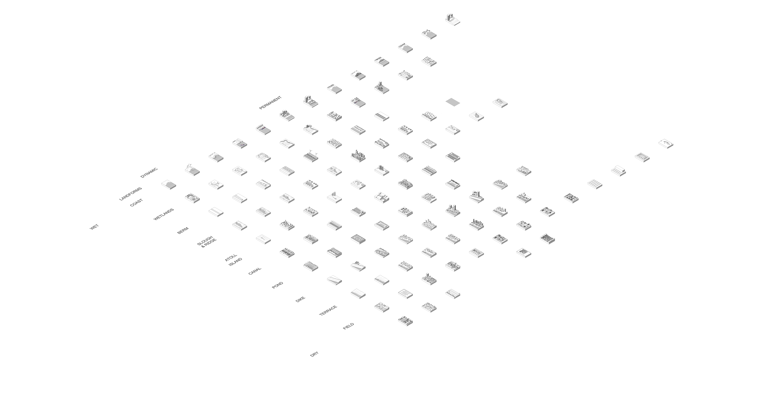
The code is broken into a matrix composed of three segments: Landscape (Land-form) + Land Use + a variable (Density / Flooding). Land uses and buildings are then arranged along an axis of flexibility from "Dynamic" (such as wetlands) to "Stata" (such as airports) and from "Wet" to "Dry" along a gradient of flooding variability.