Ecology of Failure: from risk to resilience in local infrastructure
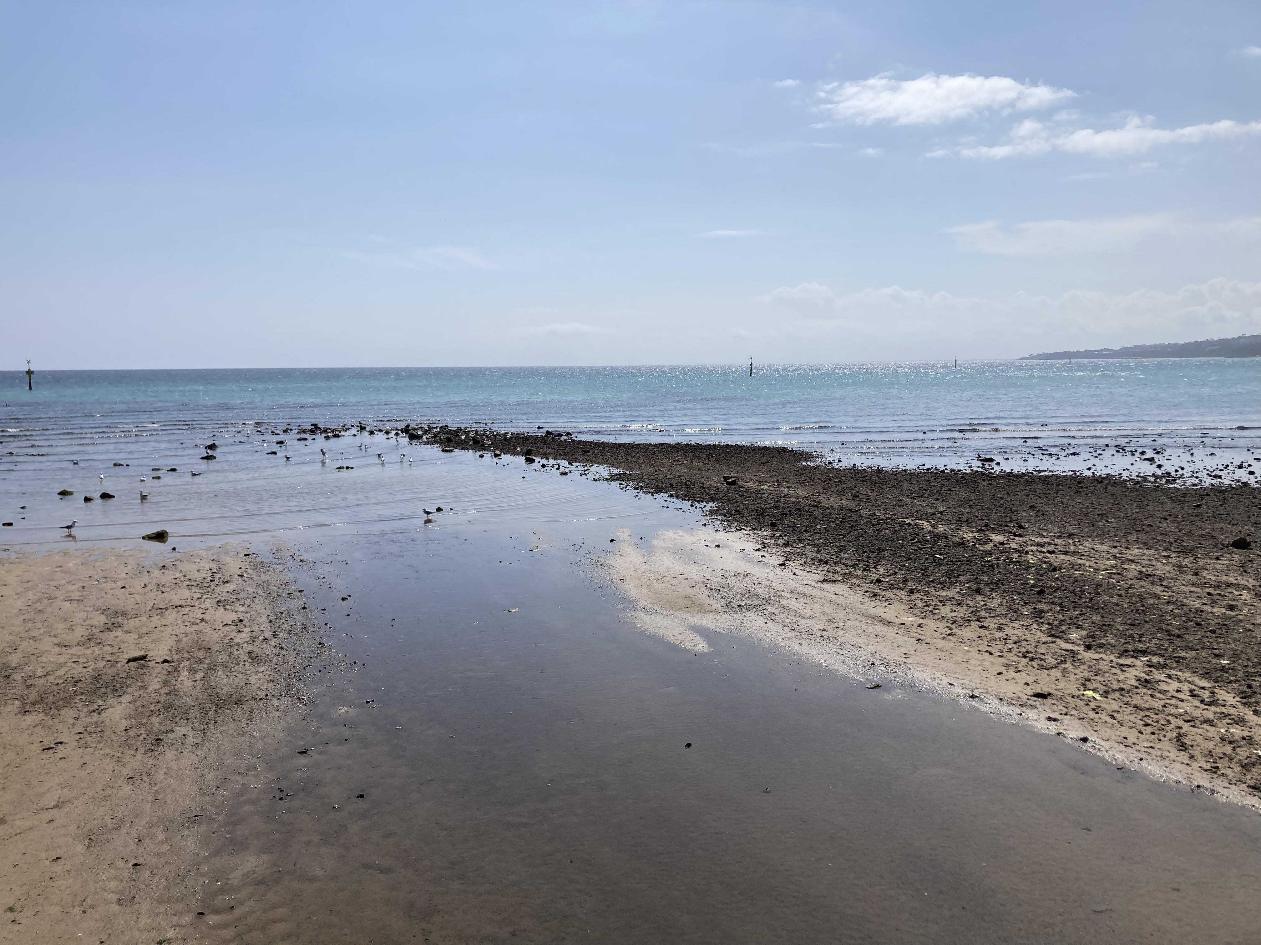
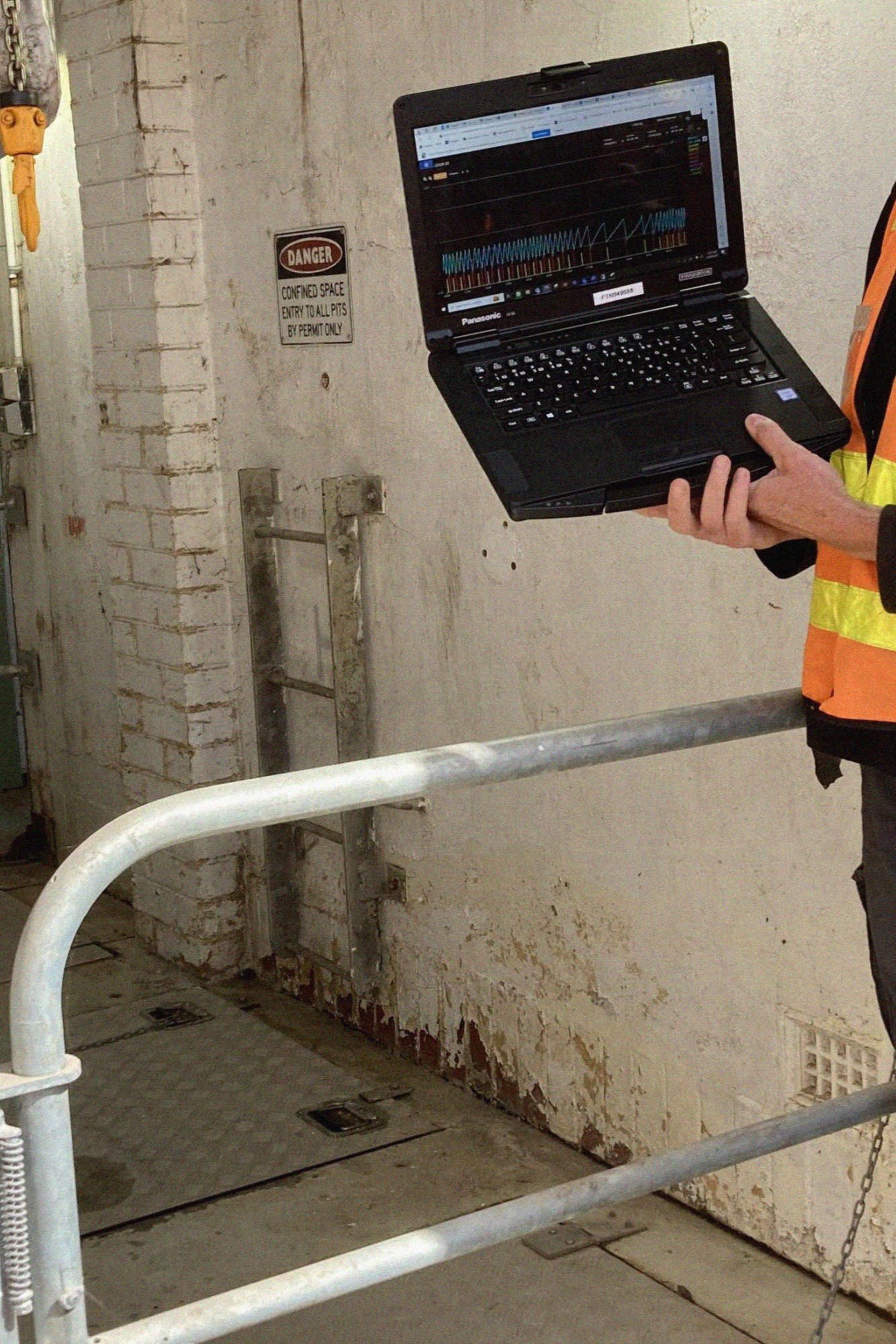
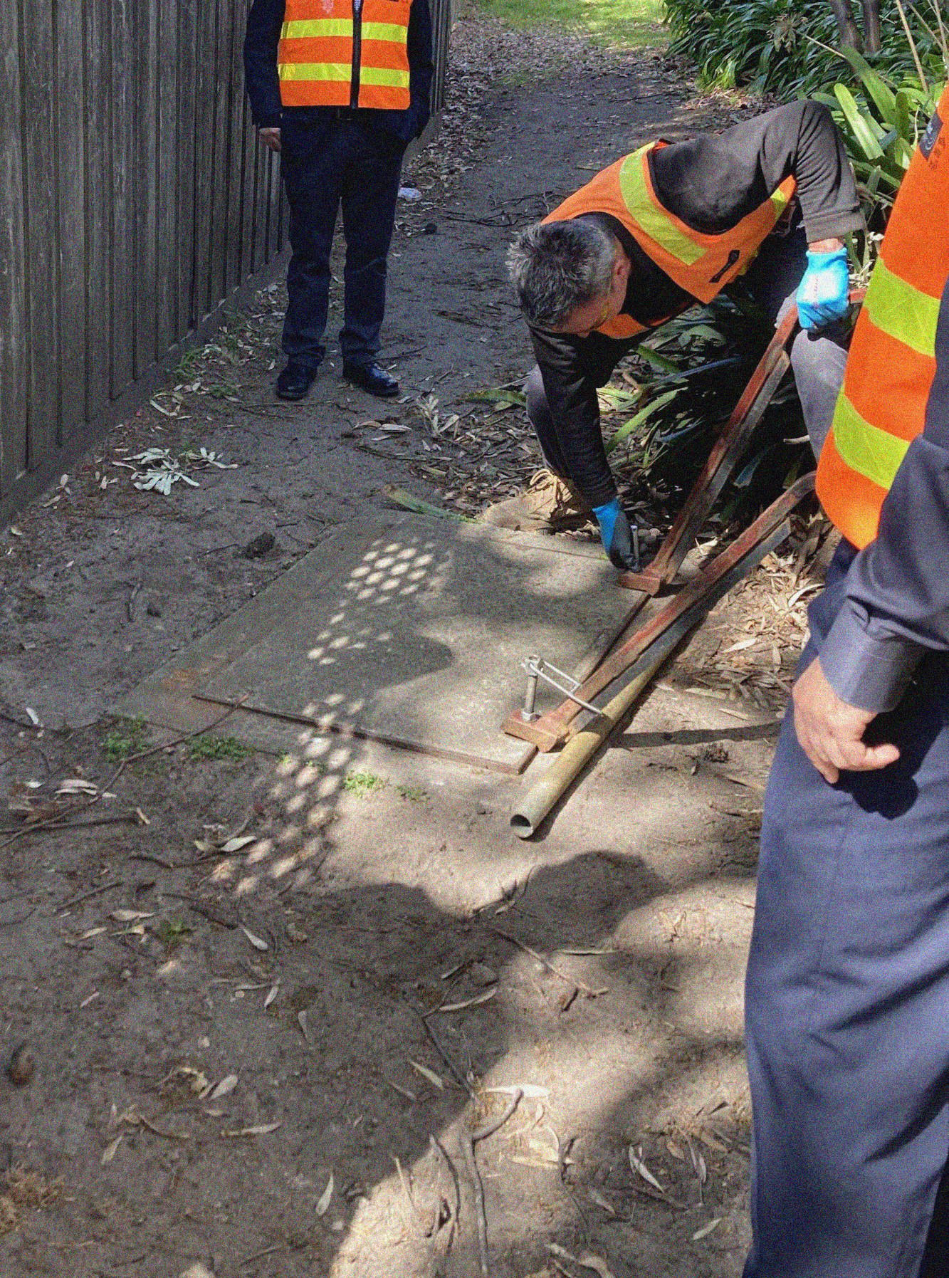
Note – This project is currently ‘in action’ and undergoing rapid development. It was precipitated with a site visit to the South East Water offices, wherein we visited Cook Street Sewer Pump Station as well as Tanti Creek Estuary, and also undertook a manhole inspection (Frankston, VIC – September 2023). Many of the images shown are WIP and to generate dialogue rather than final products.
After Frederick Law Olmsted visited the Great Chicago Fire in 1871, he wrote about it in a short text for The Nation. He measured the space of the damage, the ways that locations previously separated by dense buildings were now available to one another, and the distance from which dangerous heat could be felt, as well as the distance from the epicenter to which people and objects were scattered in the aftermath. Studying fire presented the possibility of a new landscape with new separations, vantage points, and visual corridors that would even help to prevent subsequent fires.
- Keller Easterling, The Ecology of Failure
Core Working Team
- RIIS – Resilient Intelligent Infrastructure Systems
CSDILA – The Centre for Spatial Data Infrastructures and Land Administration
A/Prof Alice Kesminas
Ensiyeh Javaherian Pour – PhD Candidate
Behnam Atazadeh – PhD Candidate - South East Water
David Norris – GIS Development Officer
- UEDLAB – Urban Ecology and Design Laboratory
Prof Alex Felson
Michaela Prunotto – Research Assistant
Project background (CSDILA)
- Planning and managing utility networks is important to reduce overflow and minimise leakages.
- Information on the total number of building sites, roofs and sewer systems connected to the storm drainage network is required.
- 3D spatial information on the network helps to locate elements that are not functioning properly.
- It is necessary to assess the impact of a natural or man-made disaster on networks and analyse how their failure affects buildings and inhabitants.
Initial queries (UEDLAB)
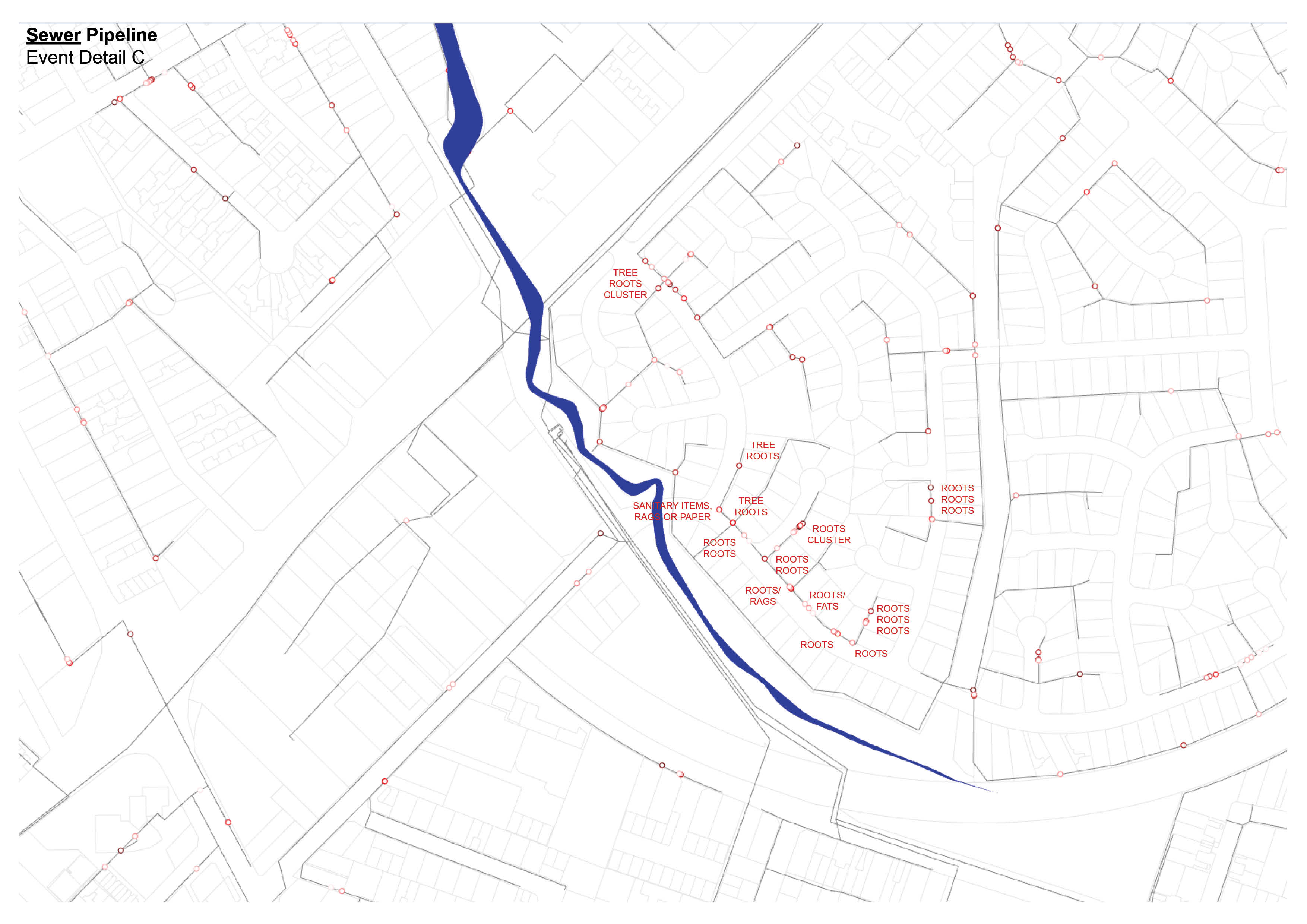
- Considering root blockage as a frequent cause of infrastructural failure, how do trees, topography and pipelines interface in Mornington?
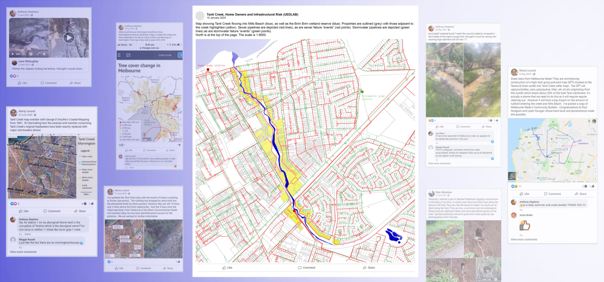
- With reference to the Friends of Tanti Creek social media group – wherein Tanti Creek’s health is informally monitored – as well as spatial data, how do homeowners, infrastructure and the creek interact?
- What is the capacity (volume and slack) of Frankston’s stormwater and sewage infrastructure, as indicated by flood events?


Objectives and deliverables (CSDILA)
- To formulate a framework for 3D water utility spatial data integration with signal processing for underground assets.
- Design and develop a pipeline for location-based, underground 2D and 3D and sensor data integration (i.e. graph database).
- To design an automated detection process for the system’s health.
- Build analytics modules to support quantitative leakage detection, enabling preventive and corrective action decision making.
- To design a predictive scenario builder for climate models – mitigation and future proofing.
- To develop a prototype system to examine the validity of the designed framework. The goal is a no spill network.
Next steps (CSDILA with UEDLAB)
- Development of 3D spatial digital twin of underground utilities.
- Finalise 3D graph database design for underground utilities.
- Refine analysis, especially at a detailed scale.
- Iterate queries in conversation with other teams.
- Identify leak detection zones of interest based on ecological principles.
- Consider the potential for designed interventions within or impacting these areas.