Belize Climate Resilience and Adaptation Tourism Masterplan
+ Location: Belize, Central America
+ Partners: Hansen Partnerships, Belize Tourism Board, Siqing Chen, GIS Staff in ABP, UEDLAB.
+ Dates: 2021-2022
+ Funds: $171k USD
In collaboration with Hansen Partnerships, the University of Melbourne (ABP), and the University of Belize, we are building on the Belize National Sustainable Tourism Masterplan (NSTMP) (2011) to provide an overview of critical priorities focusing on climate adaptation and resilience for the nation of Belize.
Belize’s marine and terrestrial reserves represent some of the riches most intact ecosystems in the world. Belize is also culturally rich with its Mayan, Spanish, Garifuna and Creole history which translates into its food, music and art. Together, this mixture of culture and nature provide a unique tourism destination. The tourism industry should continue to support conservation, management and upgrading of these ecological and cultural environments to ensure Belize’s long-term viability. The Belize Tourism Board is seeking to expand their positive influence over how development occurs in the country.
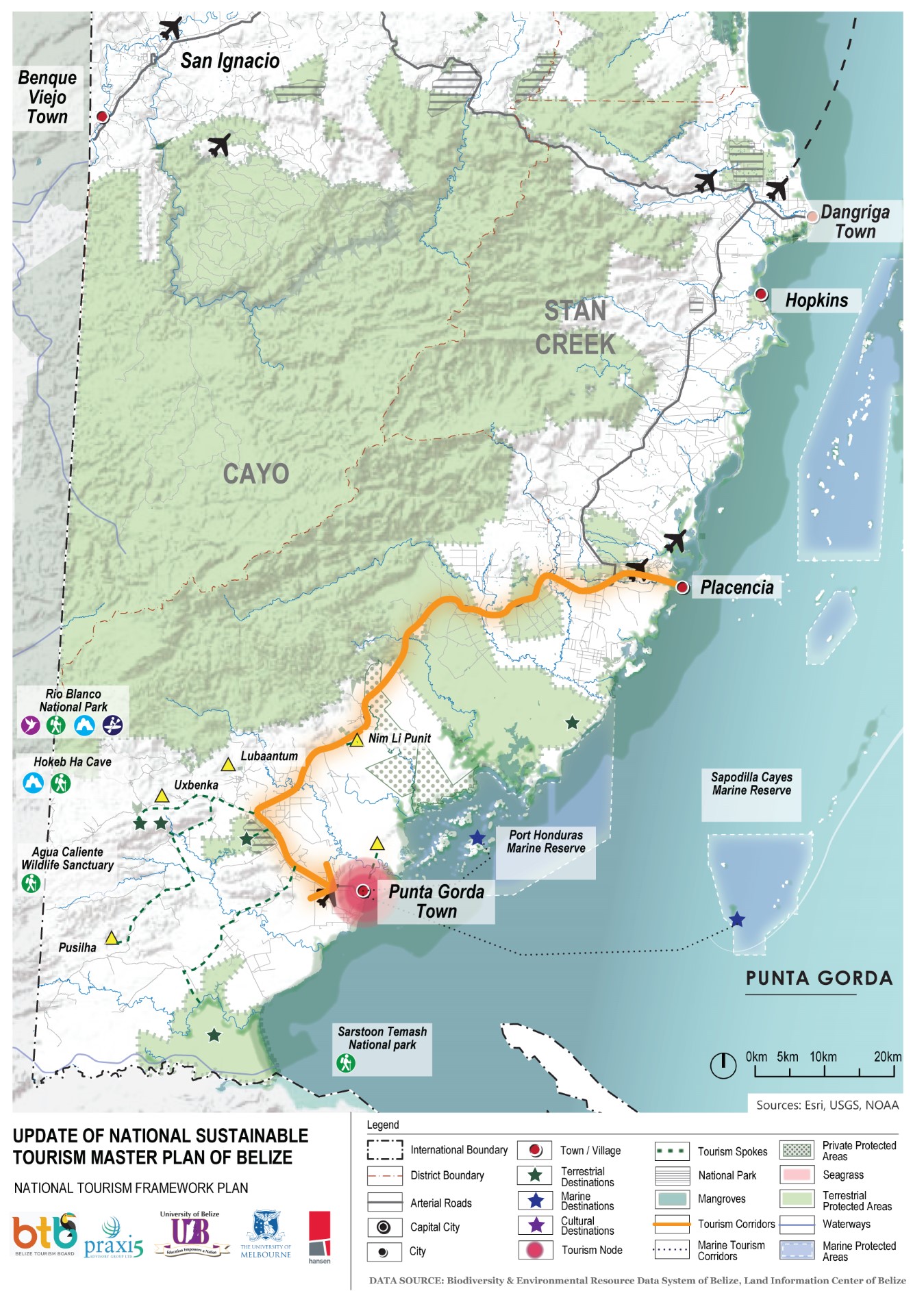
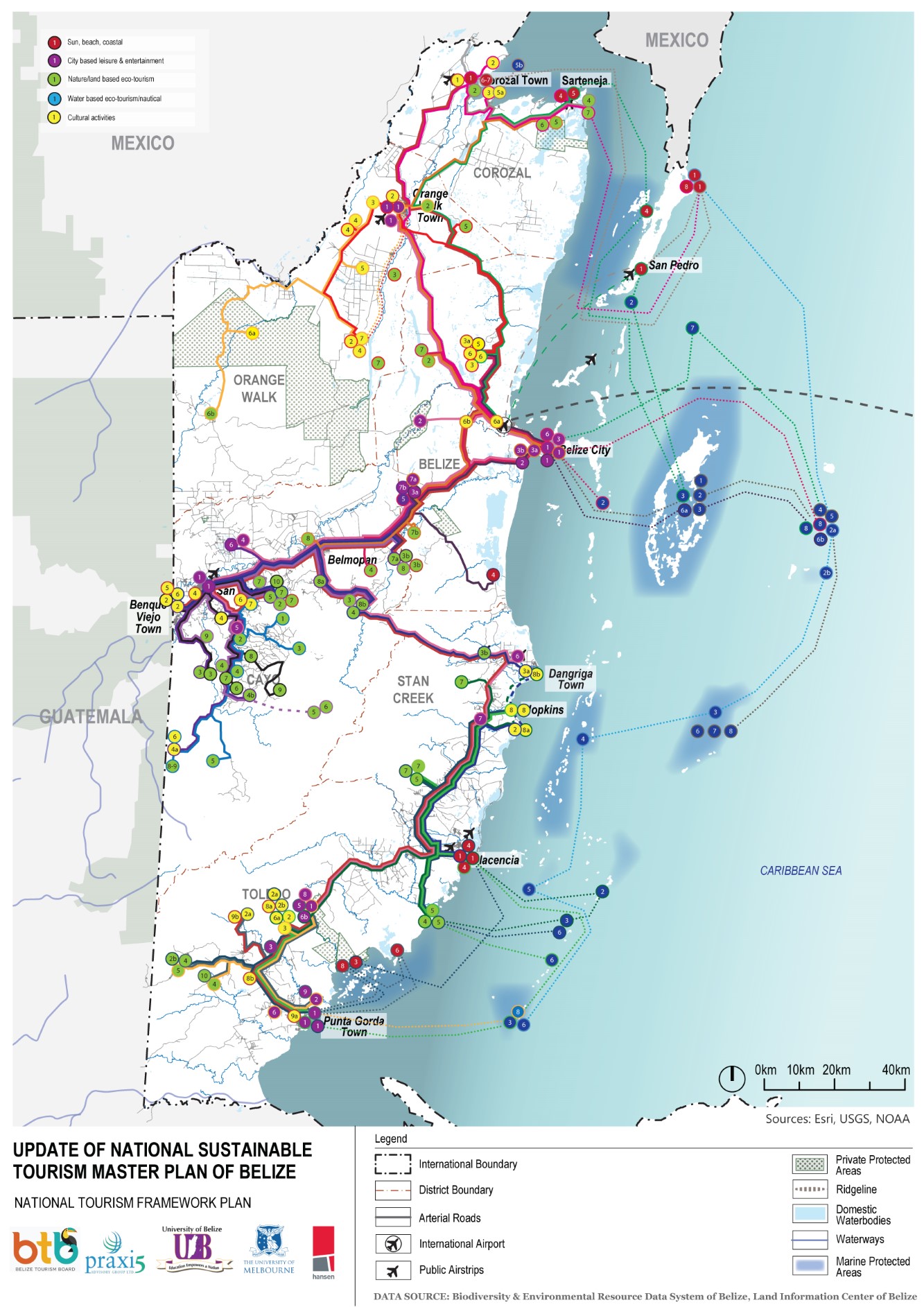
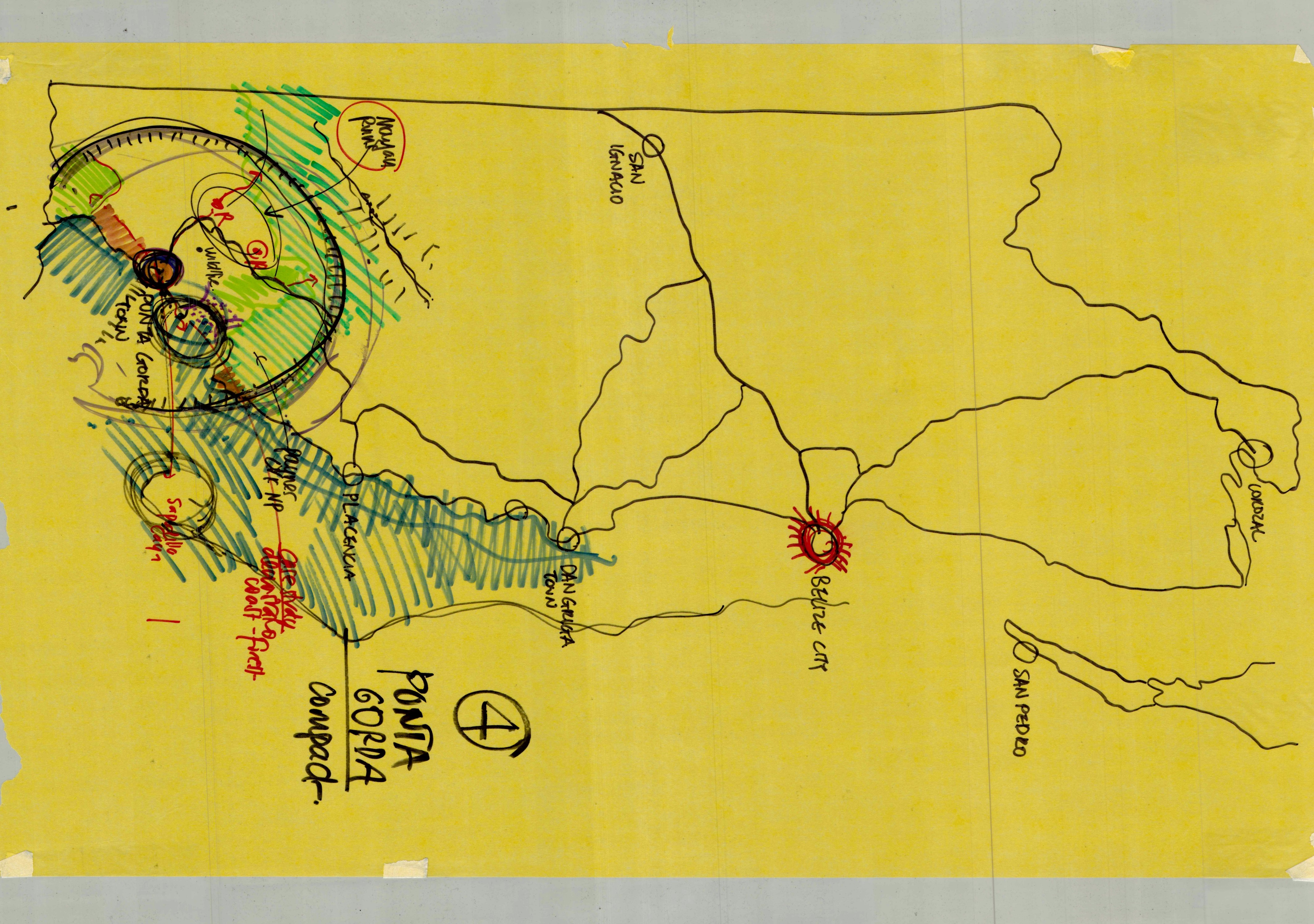
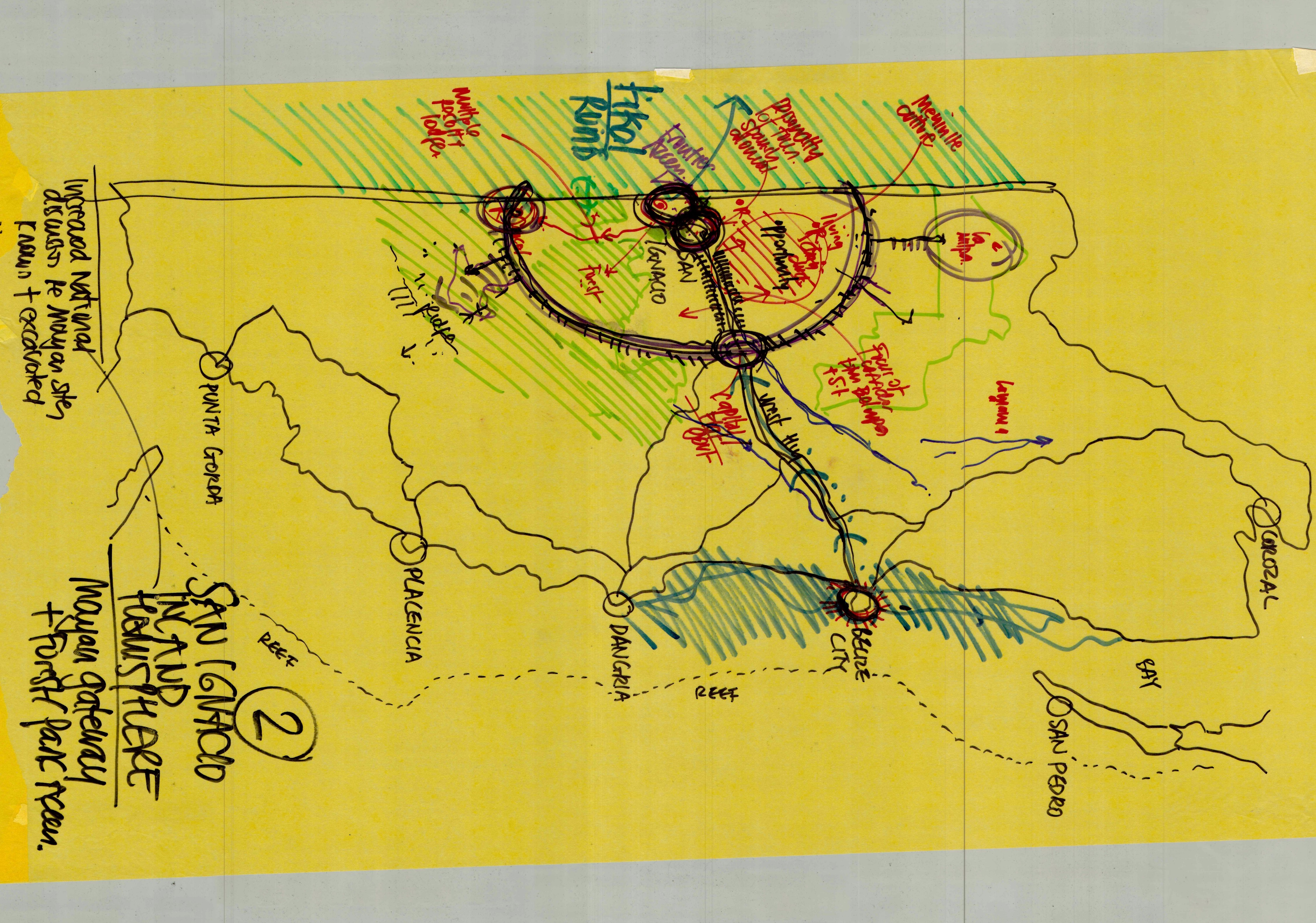
Our work compliments the first volume on recommendations and focuses on GIS spatial planning approaches for three regional areas (see Fig. 1) and three zoomed in sites within each region. The mapping and analysis provide region-to-site-specific climate adaptation and resilience strategies supporting tourism for the near, mid and long term. Approaches include pertinent strategic, physical planning and operational approaches addressing critical issues we identified in the tourism sector. Given the interconnected nature of tourism to many other sectors of livelihood, conservation areas, economics and culture across Belize, the proposals provide a broad and multi-sectorial contribution for Belizeans to impact International, Regional and National tourism flows.

Research Process
Our process was informed through a review of the existing NSTMP documentation, and identification of significant contemporary issues facing the tourism industry today. To establish local community guidance, we orchestrated a series of facilitated workshops conducted online in July-August 2022 as well as an extended site visit for two weeks from 16th January through the 28th. We met with groups across the country.


Living with & Planning for Flooding
Belize is vulnerable to hurricanes, storms and associated flooding, wind damage, and storm surge. The country’s low-lying terrain exacerbates the effects of flooding and sea level rise. Belize has experienced 14 storm events during the period 1931- 2010, with damage to agriculture and tourism sectors. Low-lying coastal terrain including Belize City and the many Belizean islands are prone to storm flooding and will be impacted by sea level rise. Many rivers also flow through Belize and can flood with torrential rain in the high mountains to the west. Most of Belize’s infrastructure such as public buildings, health, commercial and transportation facilities are on or near the coast or river. Belize is also at risk to extreme temperature events and drought in certain areas. According to the Natural Disaster Hotspot study by the WB, Belize is the 61st highest exposed country for relative mortality risk from multiple hazards in the world and ranked 8th out of 167 countries for climate risk.
Given Belize’s terrestrial and coastal condition, the popularity of maritime and reef tourism, careful planning and investment needs to go into the tourism locations for hurricanes and flooding. Flooding will impact the capacity for a ‘business as usual’ approach. Recognising the risks associated with flooding, it is critical to develop site scale near-, mid- and long-term adaptation strategies. Belize is also reliant on outside funding to support large scale infrastructure investments, making it essential to establish clear planning efforts.
Belize City
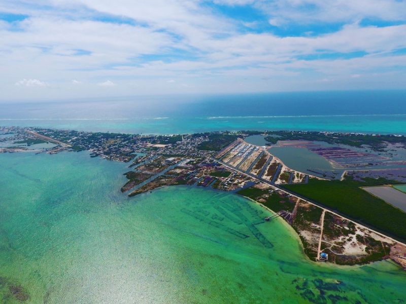
Belize City is a coastal settlement along the Carribean with a rich history and cultural background. Today, over 60,000 inhabitants populate Belize. It is no longer the capital, but it does serve as the finance centre and he principal port and industrial hub. The limited tourism options within Belize City and crime rate contribute to tourists mostly passing through the city and on their way to other destinations. Hurricanes and flood risk pose one of the biggest challenges for Belize City. These include recent hurricanes and major events such as Hurricane Hattie, (October 1961) which heavily impacted the city.
Belize City sits below sea level and faces risk of pluvial (extreme rainfall event), fluvial (river) and tidal and coastal flooding. High ground water causes localised flooding across many neighbourhoods. The Belize River, the largest and most historically important river also flows near Belize City. It drains more than one quarter of the country flowing along the northern edge of the Maya Mountains. It was once a major trade corridor to Guatemala. This river flows into Haulover Creek and can create flood issues. In addition, the three canals running through the city’s south side, including Burdon, East and Collet canals help to drain the city during storm events. The canals and the Haulover Creek can also overflow and flood neighbourhoods, distributing water during heavy rains, flooding and contaminating areas around them. Sluice gates and pumps are being used to manage the canals; active management prior to, during and after flood events is essential.
Belize City has issues with its sewage and septic. This creates issues for managing the town waste over time. Council will need to improve efficiency of the existing sewage treatment facilities and assess the lagoon treatment sewage facilities for possible expansion and upgrades. Belize City, like other locations should establish waste management for new development, especially those within the sewage treatment zone that will further stain the existing system. Community septic and upgrades to the current soakaways will be necessary. Establishing a public awareness program for homeowners and developers is essential to improve current practices.

Climate Adaptation, Planning and & Spatial Strategies
In addition to establishing a regional adaptation plan, Belize City should build up its local tourism opportunities and invest in targeted tourism destination sites that can accommodate cruise ship passengers and provide additional local activities that are built to accommodate the large number of cruise ship visitors. We recommend that all investments in road improvements, sanitation and tourism investment should contribute to a should and should serve for day trips and for learning about the history, culture, music and nature of Belize.
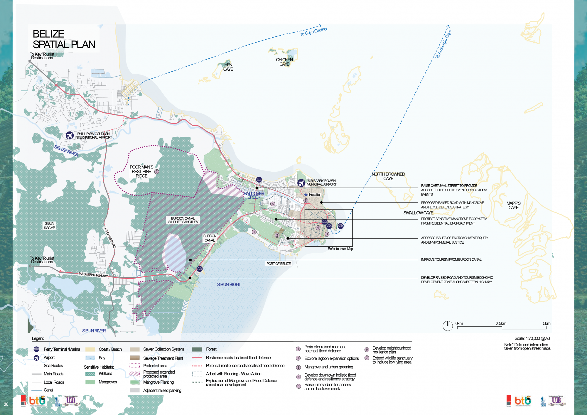
Alongside adaptation and resiliency planning that needs to occur at the neighbourhood scale, we propose a combination of flood mitigation and management strategies. This includes selected raised roads, management of sewage, conservation of existing large scale wetland areas for managing water and increased green infrastructure as urban parkland. We also recommend education and beautification of the large to small scale drainage network that exists across the city. This is an unrecognised asset that requires upkeep and development controls. The canals and the distributed drainage network are a critical part of the water management. Given the critical function of the canals and their failure during large storm and flood events, recognising how the system works and incorporating ongoing upkeep and management is crucial.