Water & Urban Hydrology
Water flows through cities in a variety of forms. Water scarcity and climate change are creating serious pressures and revealing the inefficiencies of our infrastructure for managing water sustainably.
Landscape architects need to further infiltrate storm-water and wastewater management in order to influence change. Landscape architects are already active in watershed management, urban greening and bio-retention. The territory of urban hydrology is a critical area of expansion and development for landscape architects, especially around whole water systems and water security.
Alex Felson, under the UEDLAB, has built bio-retention gardens in Bridgeport (Connecticut, USA) and developed river and floodplain studies and projects. For his PhD, Felson worked on amphibian reproduction, growth and survival across ponds in a proposed urban development. Incorporating river and coastal flooding in teaching and as projects, particularly the Earth Stewardship Initiative, which focused on four locations across the USA including:
- American River Parkway in Sacramento, California
- The park systems of Louisville, Kentucky
- Green infrastructure in Portland, Oregon
- Historic neighbourhoods in Baltimore, Maryland
Other UEDLAB collaborations have included extensive research on climate adaptation in Connecticut through the Connecticut Institute of Resilience and Climate Adaptation (CIRCA).
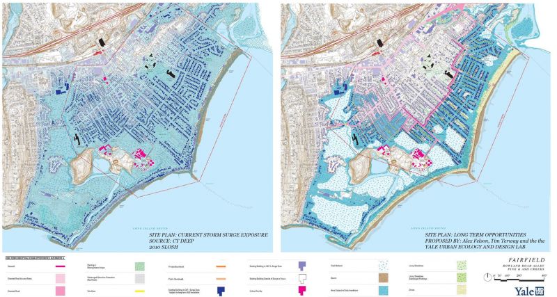
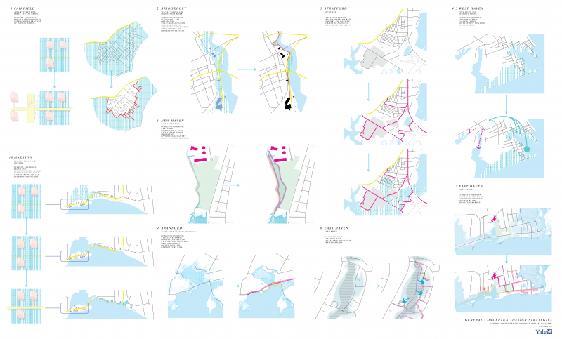
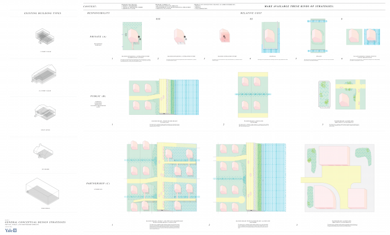
The UEDLAB developed coastal adaptation plans for municipalities in South Central Connecticut as part of a US Department of Interior Funded project. We proposed near to long term urban designs with social and ecological resiliency and investment goals. These projects provide diagnostic and contextual methodologies that are incremental and phased over time focusing on land uses strategies that engage political, economic, social and ecological systems. The strategies address land use changes and innovations in housing, landscapes and habitats, roadways and utilities, towards a cohesive transformation of an urban coastline, over time.
We included a series of maps representing short- (2020), mid- (2050s), and long-term (2080s) solutions. The plans provide transition strategies for coastal urbanised zones taking into account adapting infrastructure and road transportation systems and addressing housing at risk alongside issues of equity, human health, and ecosystem function.