Philip Goldswain
Depicting Boom Urbanism: A critical investigation of Kalgoorlie and Boulder, Western Australia, 1893-1903
Through a series of written and drawn investigations, my thesis considers the spaces, events and processes of boom urbanism and industrialisation in the East Goldfields of Western Australia between 1893 and 1903 as recorded in photographs and maps. Employing these media, underutilised in the writing of history of the built environment, the thesis examines this lacuna in Australia’s urban history.
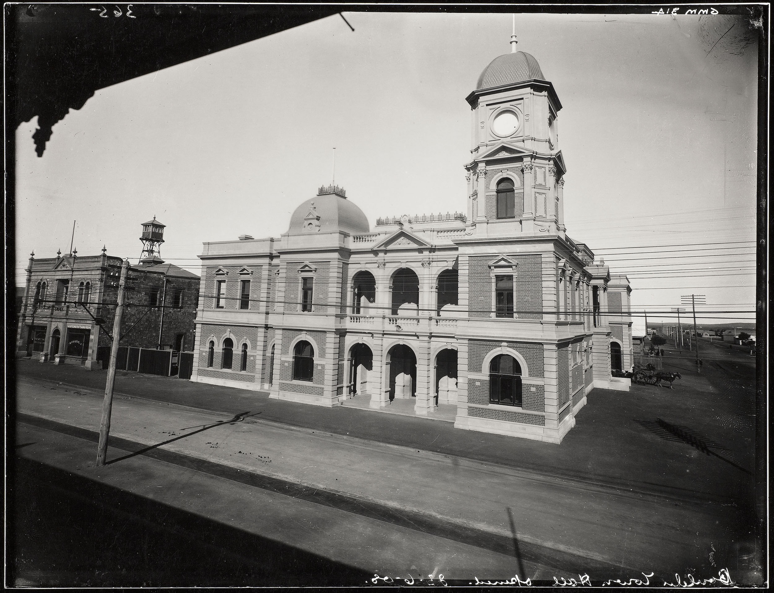
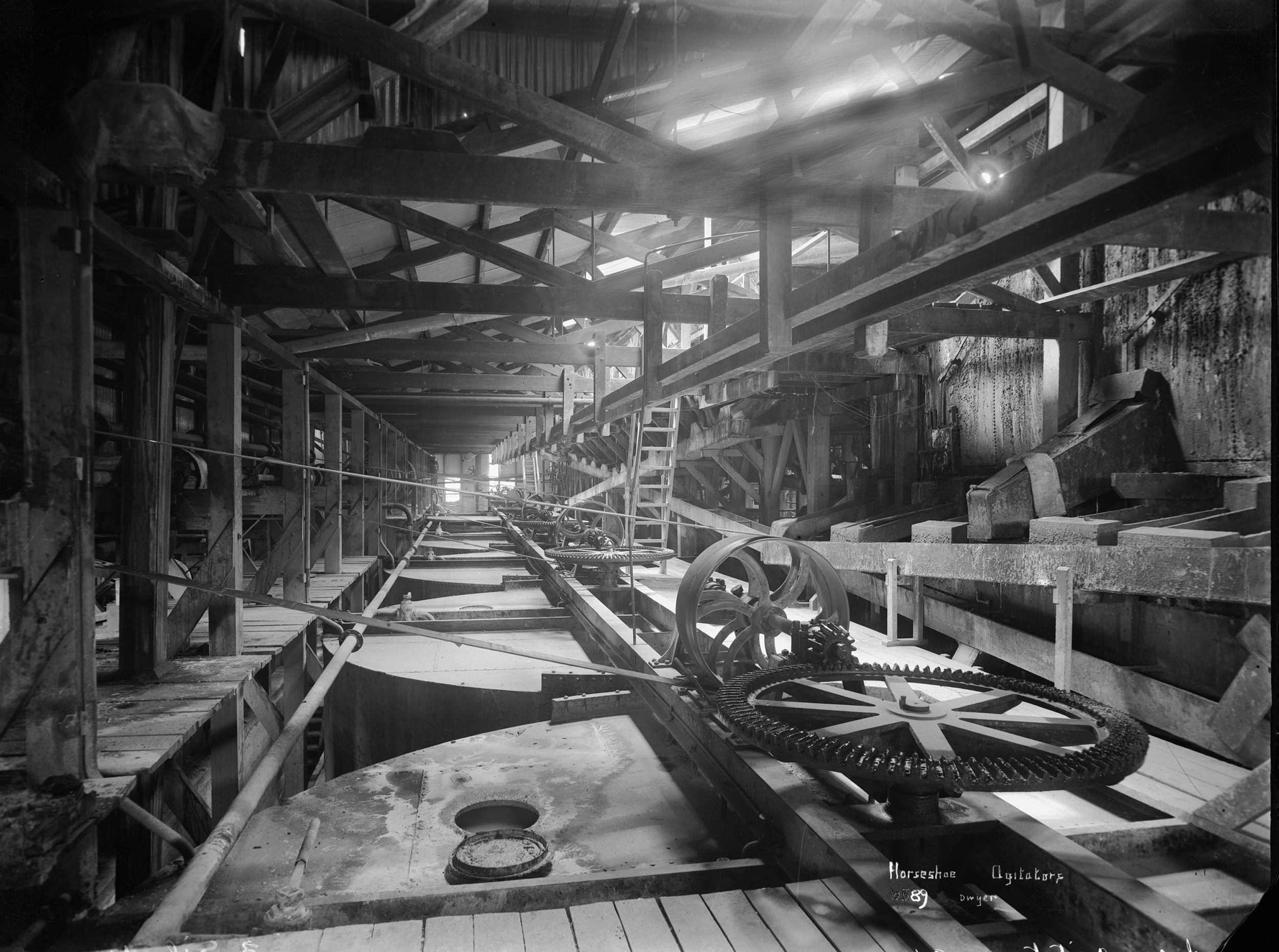
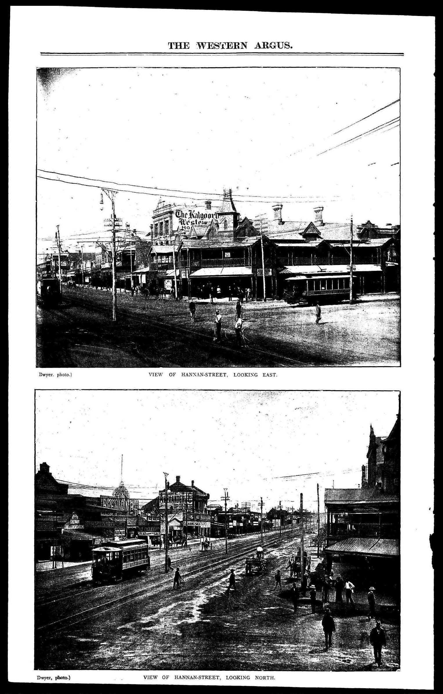
Kalgoorlie and Boulder are the locations of the last great gold rush in Australia. The discovery of alluvial and then a deep reef of gold in the East Coolgardie Goldfield has long been acknowledged as a significant moment in Western Australian and Australian history. The industrial and urban transformation of an arid woodland at the very edge of the British Empire had profound economic, social, political, urban and architectural consequences with the movement of people, ideas and technologies from eastern Australia and around the world to Western Australia.
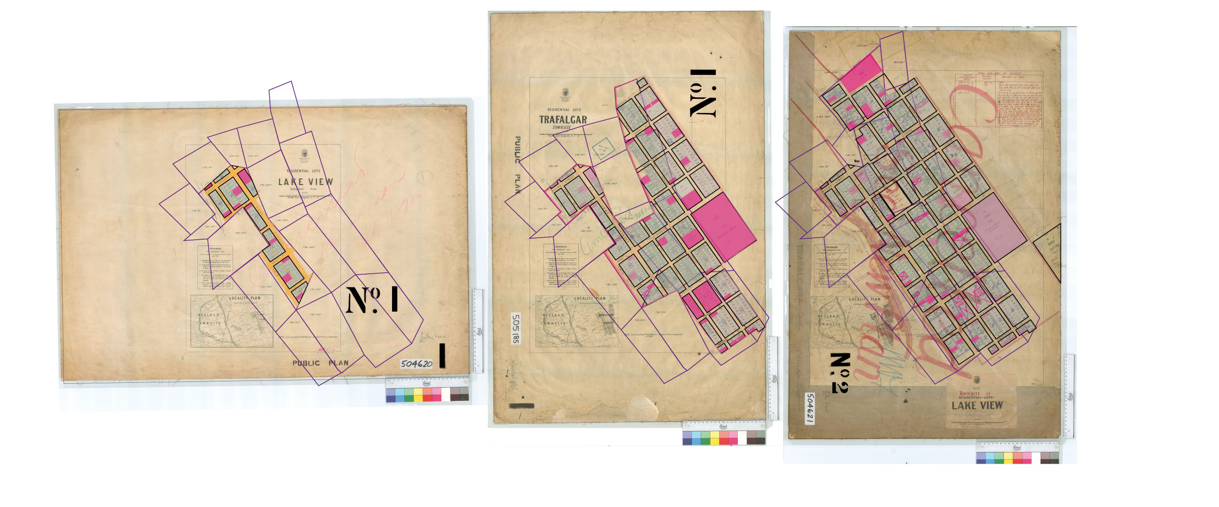
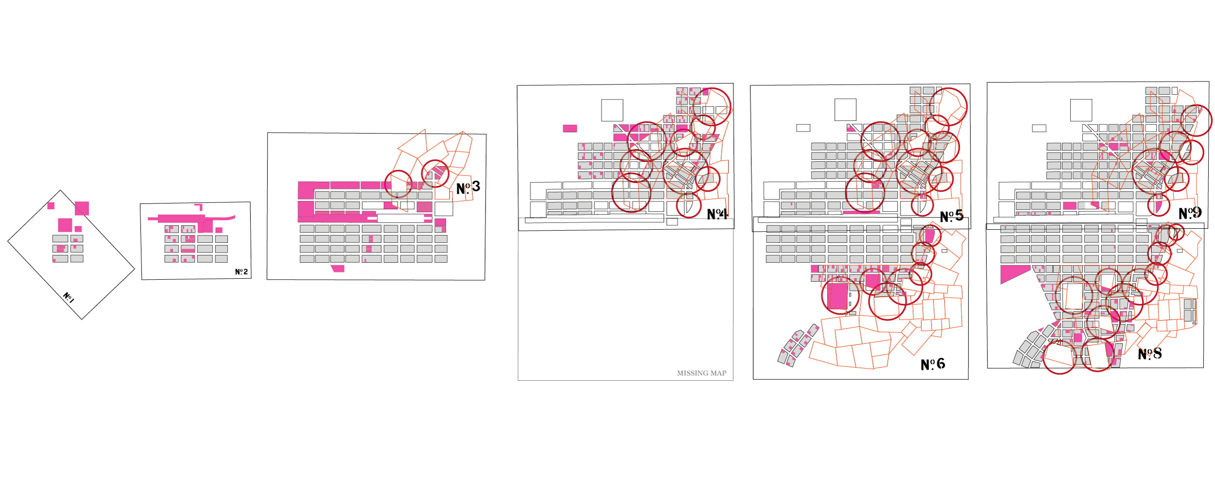
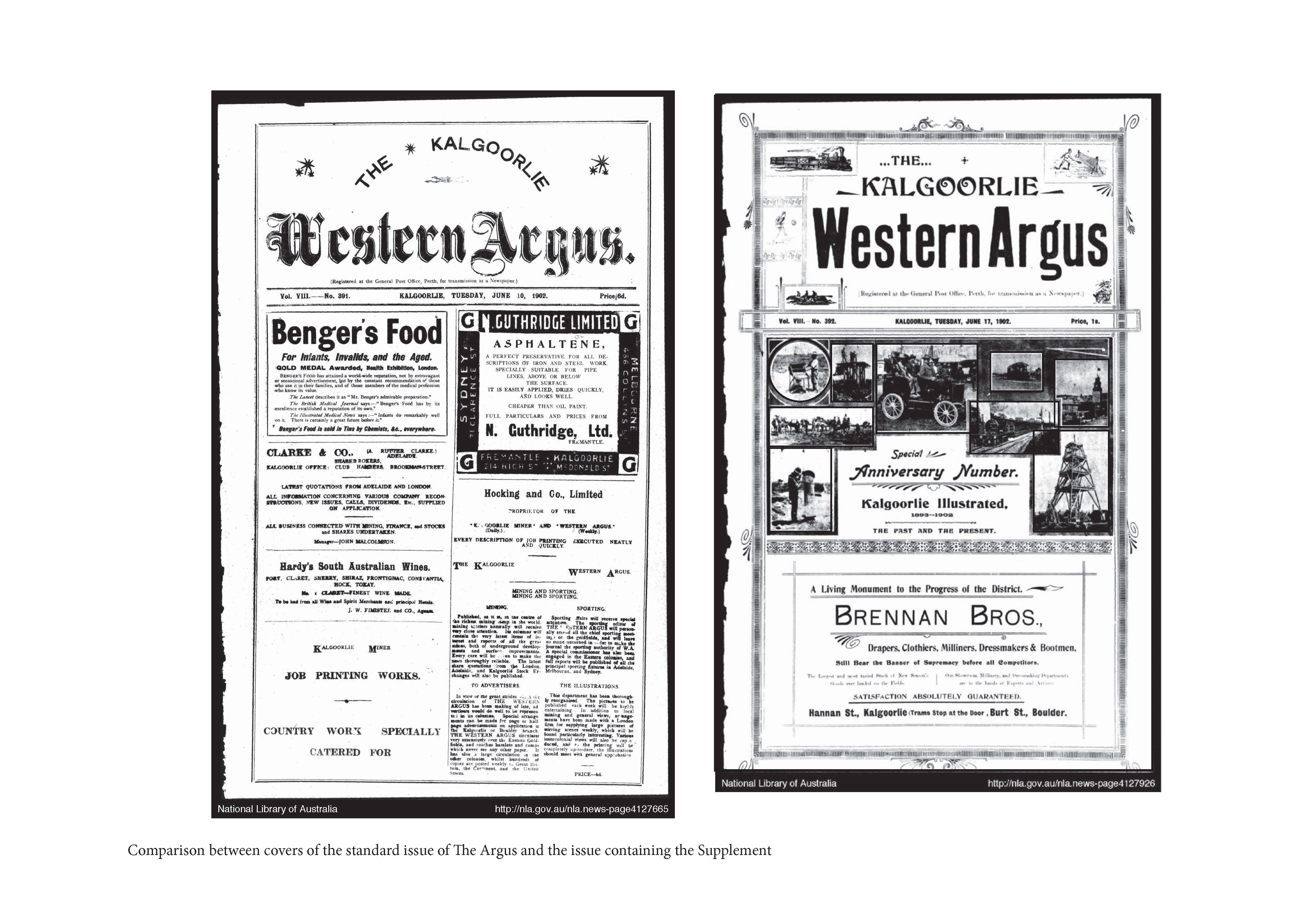
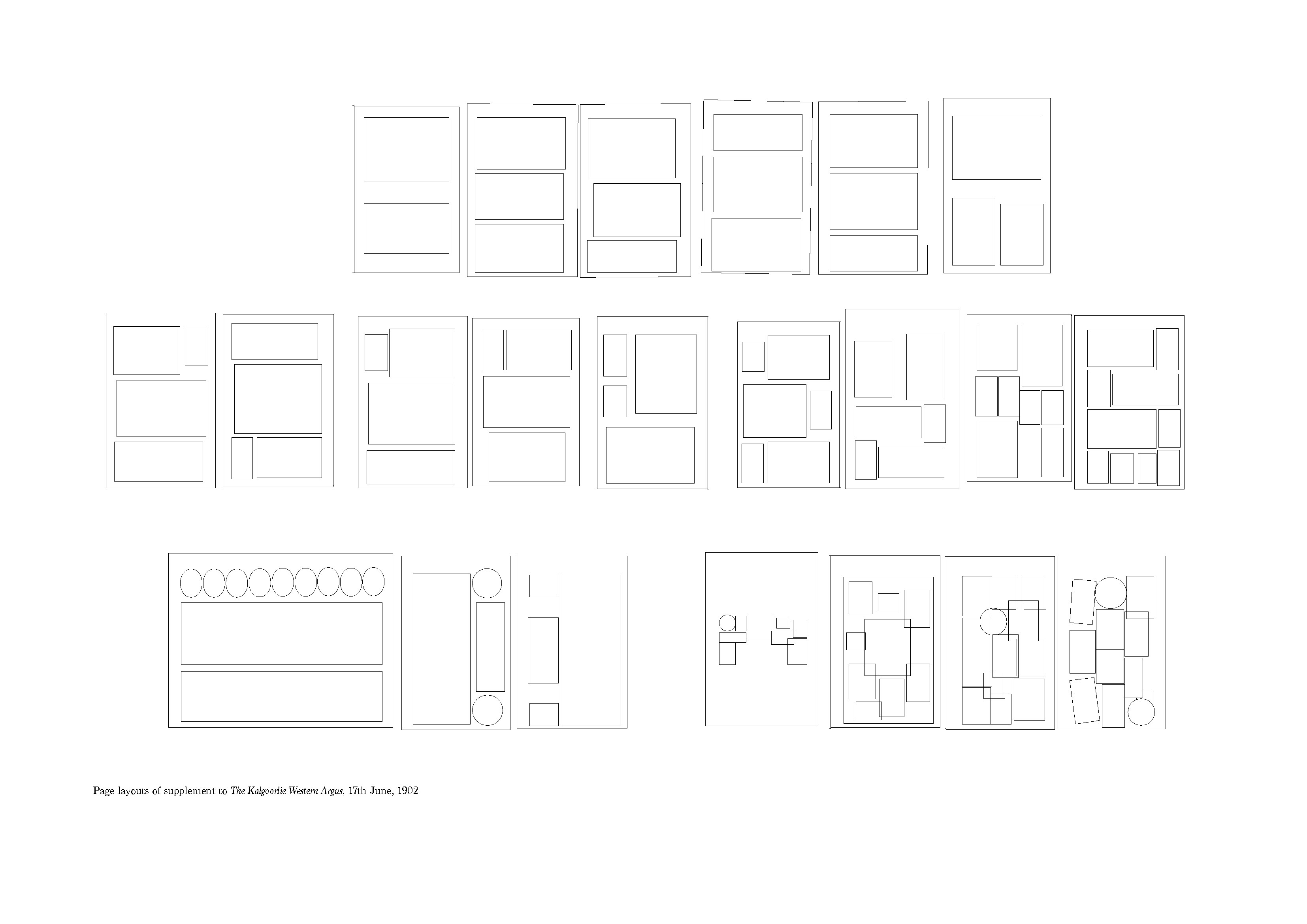
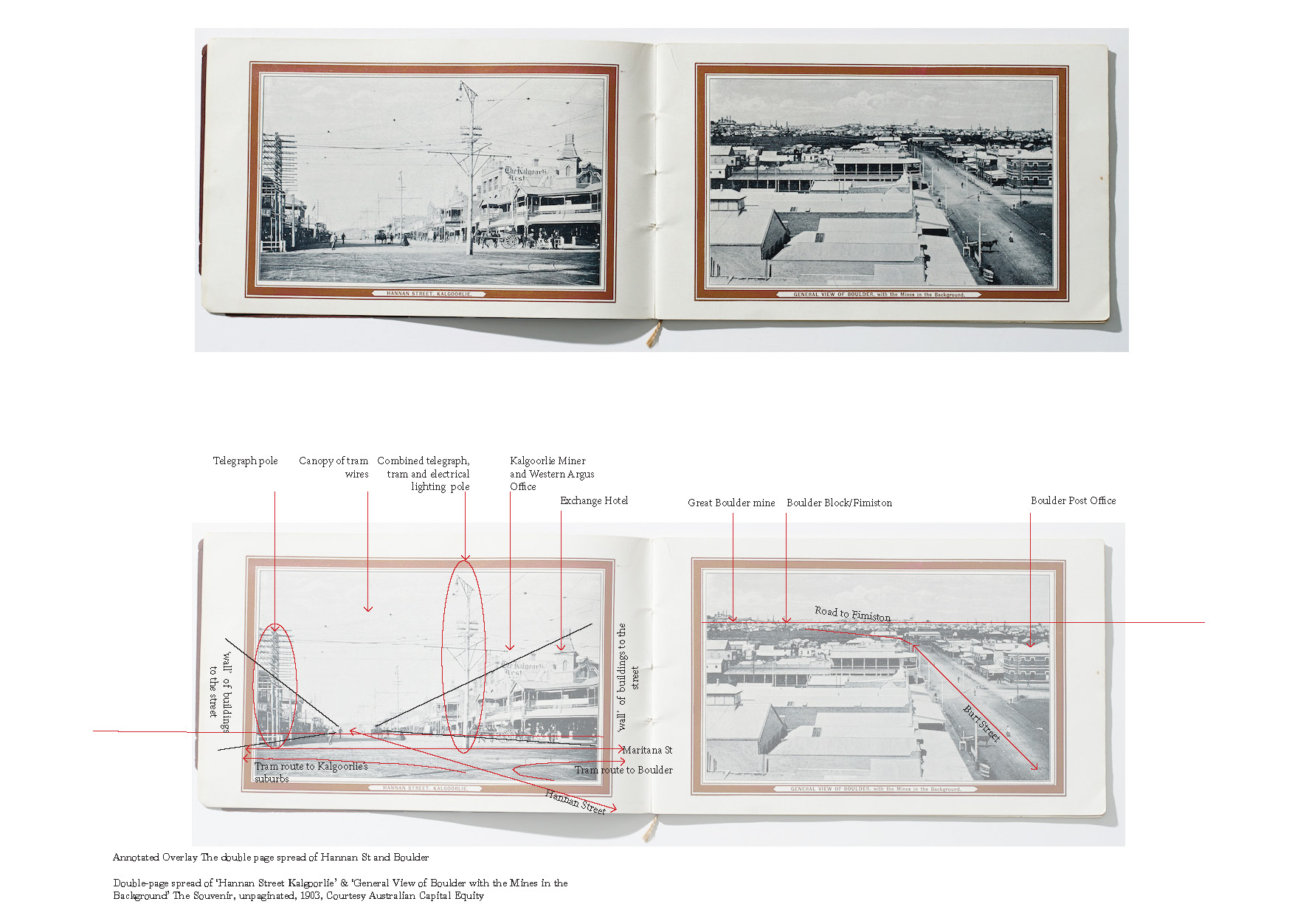
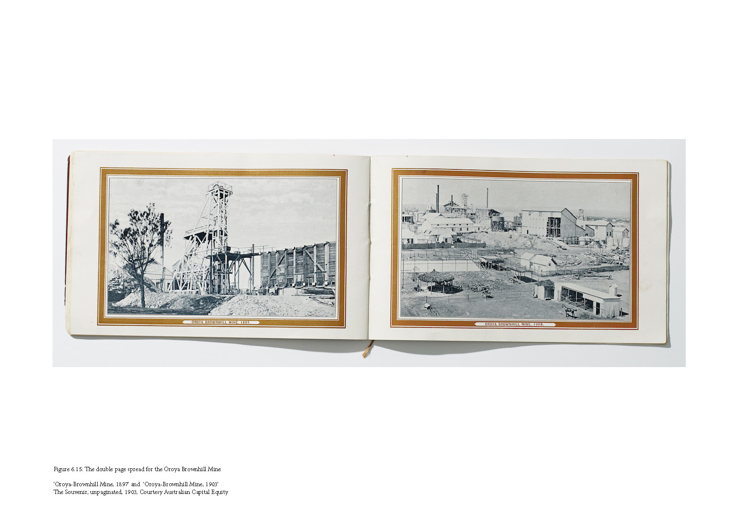
While Kalgoorlie and Boulder underwent an urban boom, the towns were concurrently influenced by a number of events that, in complex ways, affected the development of the towns in spatial terms. The thesis explores, describes and analyses a range of photo-textual and cartography objects drawn from the rich archive of visual material created during the period to understand the nature of this development. This is achieved in two stages. Firstly, the exploration of ten photo-textual objects establishes a broad spatial context of the goldfields and towns. Secondly, a more detailed examination of three ephemeral, quotidian and, until now, largely overlooked objects—a souvenir, a newspaper supplement and a series of maps—is undertaken to provide a nuanced understanding of these urban and industrial processes over time.
The research makes a number of findings. The first concerns the utilising of novel research methodologies, and the second relates to the new knowledge created through these techniques about the processes of boom urbanism. In the course of establishing and tracing serial and sequential relationships in the visual material examined, the thesis offers lessons on how such material can be used as a source for urban history. In its foregrounding of time and process, as distinct from space and product, the research advocates that visual material demands a more central place in the field of urban history. The research yields new insights and understandings of the way the complex territory of town and mine developed, and through it, a more layered sense of the urban condition emerges. The research reinforces the idea that urbanisation (and industrialisation) needs to be read as temporal even when being explored through static depictions and fixed objects such as photographs, printed matter and maps.
The research establishes a series of methods and measures for investigation and understanding of boom urbanism that can be applied to, and tested against, other places, across time and space, that have undergone similar transformations.

Philip Goldswain teaches design, architectural history and the history of photography in the School of Design at the University of Western Australia. He holds a Bachelor of Architecture from the University of Western Australia where he has taught since 2004. His research investigates the representation of architecture, landscape and the constructed environment in photographs, cartography and other ephemera with an emphasis on the time period of the late 19th century. In addition to his PhD research on the representation of Kalgoorlie, Boulder and the Western Australia goldfields, he has published on the transformation of Paris between 1850-1870 and this research has been supported by fellowships at the Getty Research Library, Los Angeles and the State Library of Victoria.