Birrarung Confluences Report
The Birrarung Confluences Report
The UEDLAB led the Birrarung Confluences Report, a conceptual and practical exploration of the Birrarung which offers innovative actions, strategies, and recommendations contributing the broader initiative being led by the Birrarung Council to develop the Great Birrarung Parklands.
The report was supported through funding, guidance and review from the Yarra River Keeper Association. The students and staff involved also participate in a course called Design with Country at the University of Melbourne which has been established as a co-education model with the Wurundjeri Woi-Wurrung Cultural Heritage Aboriginal Corporation. The document has been reviewed by the WWCHAC. The report demonstrates a near term strategy to begin to re-imagine the river as one living and integrated natural entity from source to sea.
It details how to restore key confluences through incremental schematic designs with land stewardship models that are implementable and contribute to the vision for the river.
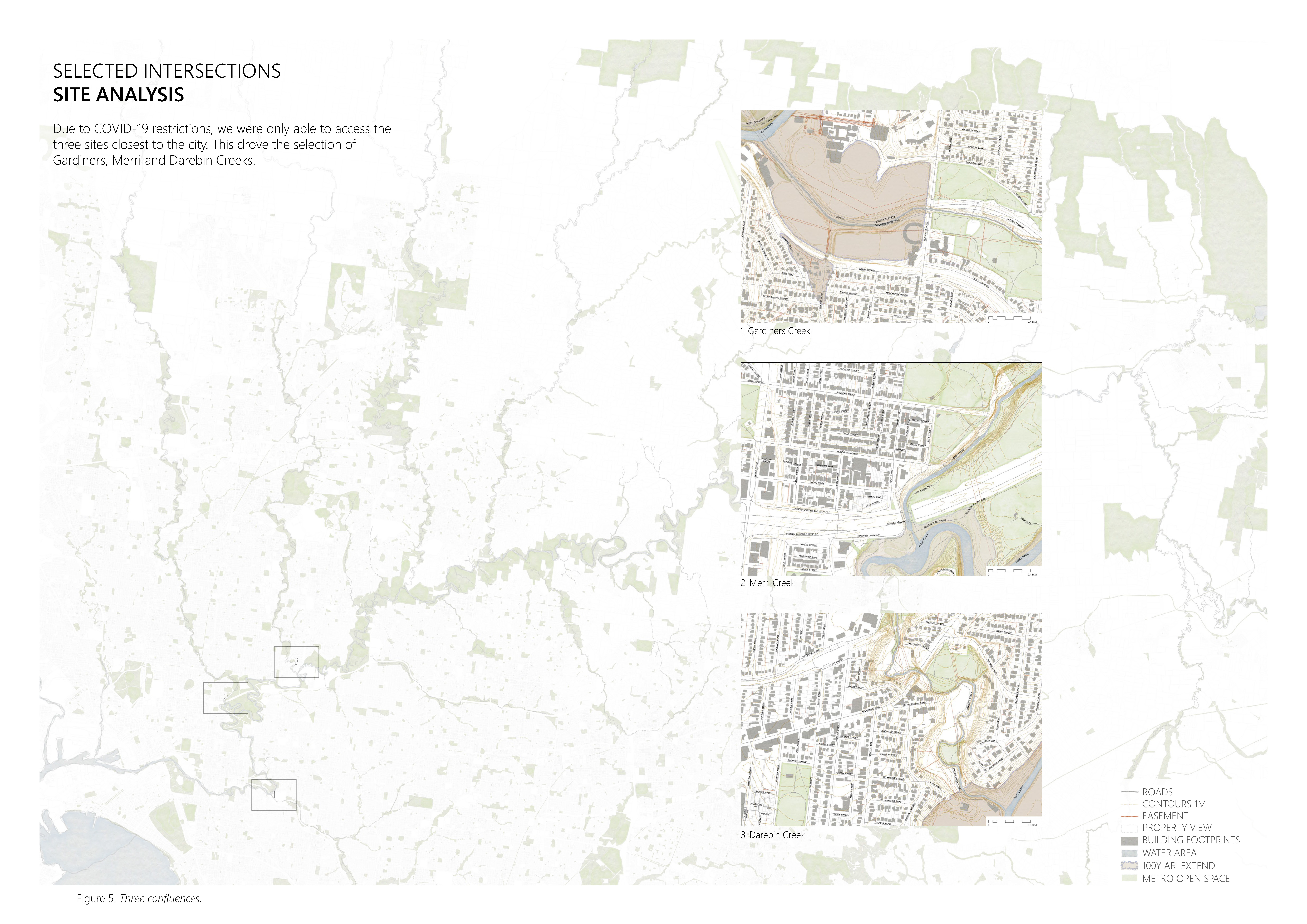
The research builds upon the concept of ‘net gain’ where the river can be improved to incorporate environmental, cultural, social, and recreational benefits. Three confluences or ‘case studies’ have been selected at the following locations: Darebin, Merri, and Gardiners Creeks (see Fig. 1). They are explored in detail to bring to life the concept of the Birrarung as a living entity. These confluences have served as meeting spaces with a long cultural history. They are sites where ecological and cultural regeneration can benefit the river and its tributaries. Each confluence was approached as a site with its own unique enhanced opportunities. Future research and action could see all confluences with the river experience ‘net gain’ using a similar methodology.

Each case study includes an analysis of its historical context to show how the river has been used and modified over time, a photographic essay to provide environmental, cultural, social, and recreational impressions of the site, two conceptual design maps (the first to provide key observations and opportunities of the site, the second to propose net gain and regeneration strategies) (see Fig. 2), and progressive adaptations, arranged into near-, mid- and long-term strategies. Viewed together, the resulting information provides a full picture of how to support ‘net gain’ more fully.
The process of undertaking this research has not been linear and is the result of conversations with experts, collaborators, stakeholders, and those who care for the Birrarung and waterways while building on existing research and ideas, sharing, and receiving feedback, new conversations, shared knowledge, and discovery.

The identification of opportunities for Traditional Owners to benefit from these adaptation strategies is of primary importance to this research.
Each confluence, therefore, has specific adaptation strategies that embrace the connection to Country and spirituality, support Land Back agreements, and celebrate the cultural significance of each confluence.
Six universal key recommendations have been identified through the case study assessments:
- Establish distinct regeneration zones across the district with indigenous identity providing diverse plantings and management practices.
- Improve the tributary and Birrarung aquatic habitat and water quality through watershed management, localised flood zone management and creek bed habitat regeneration.
- Establish cultural and ecological districts at and around the confluences with community building that creates activity and a place to expand around education, ecology and cultural heritage, with a strong destination.
- Amplify net gains through the development of multi-functional landscapes that build on the attributes of the Confluence.
- Negotiate a shared land holding and custodianship model to give back land access, use and ownership to Traditional Owners.
- Establish public/private re-investment programs and education programs.
